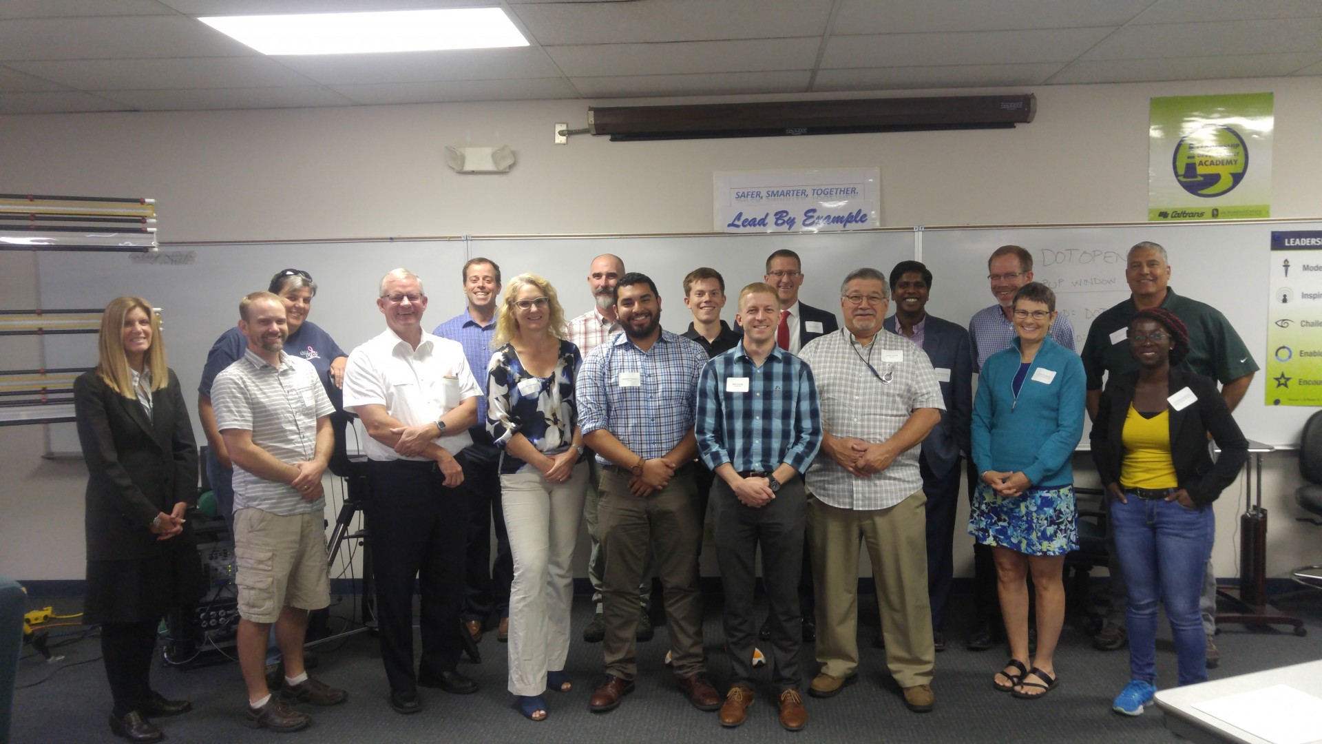
Participants in the End User Workshop on Remote Sensing for Post Wildfire Debris Flows at the Caltrans Maintenance Training Academy in Sacramento, CA in August, 2017.
–
–
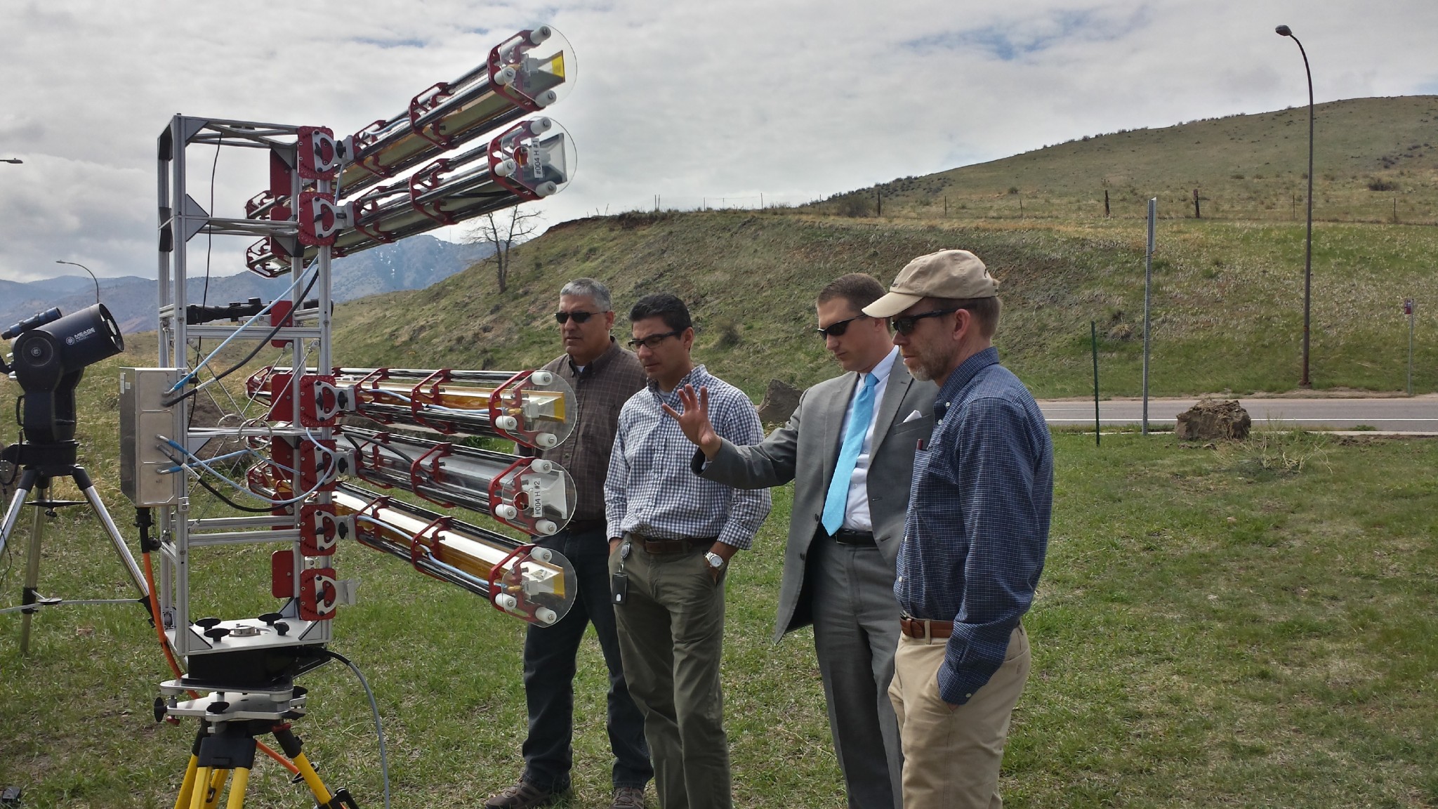
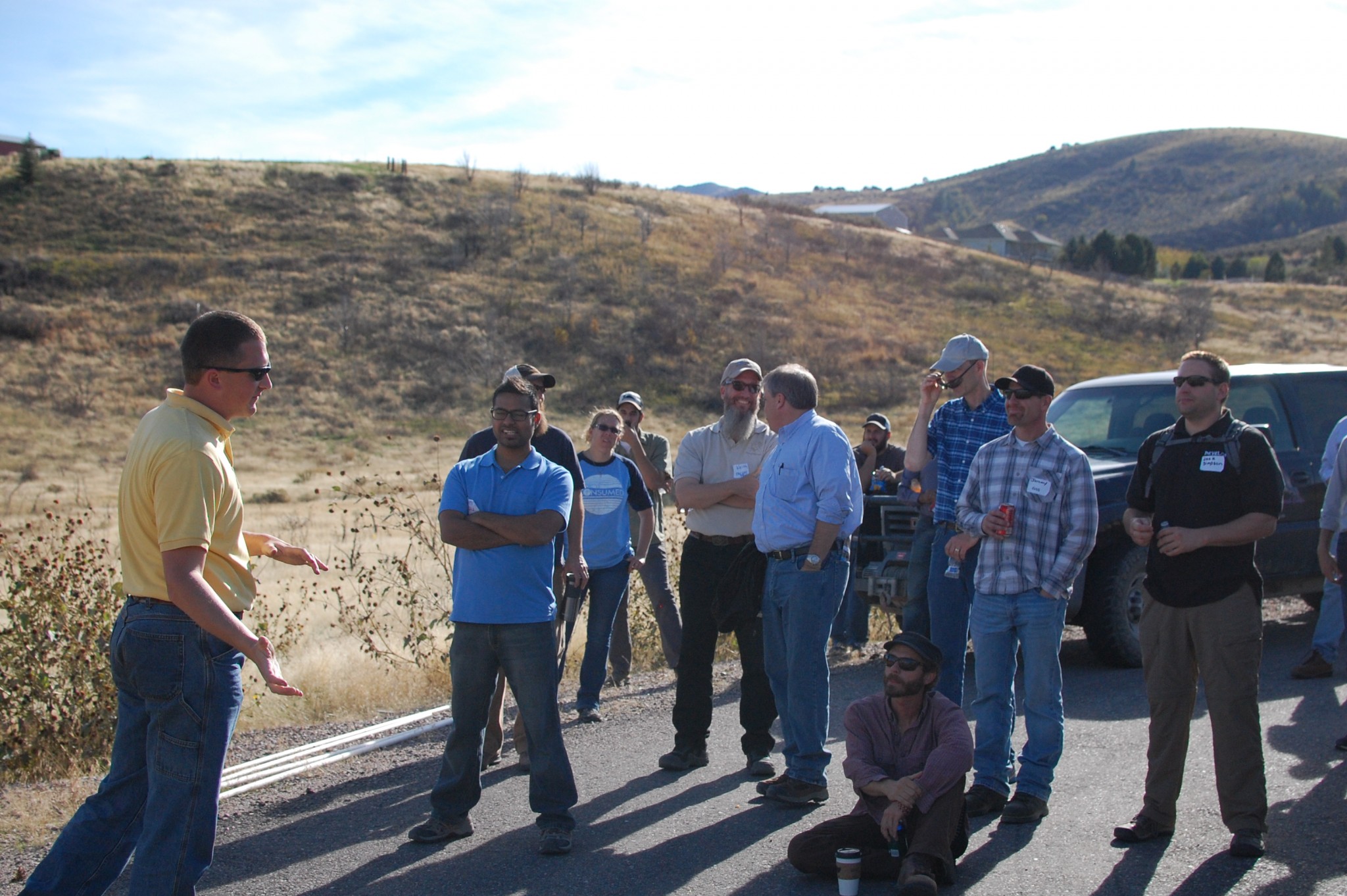
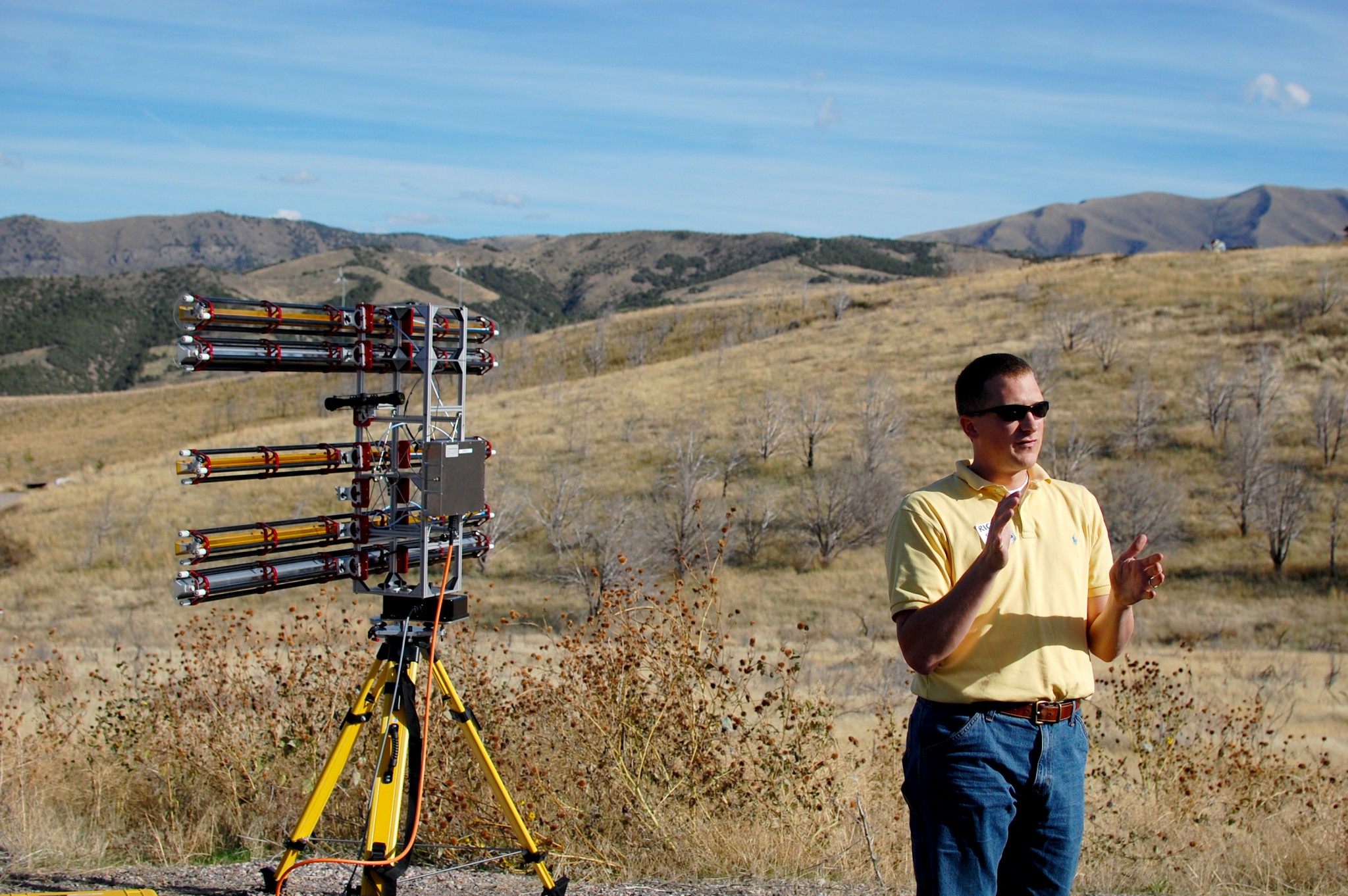
Dr. Richard Coffman explains the operation of terrestrial remote sensing technologies to members of the Technical Advisory Committee during a field demonstration in Denver, CO in April, 2016.
–
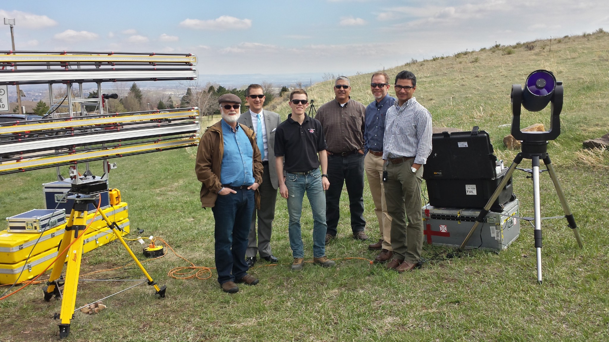
Members of the Technical Advisory Committee met in Denver, CO in April, 2016. From left to right: Bill Shaw, Richard Coffman, Sean Salazar, Rene Garcia, Scott Anderson, and Ty Ortiz.
–
–
![IMG_1621[1]](https://bpb-us-e1.wpmucdn.com/wordpressua.uark.edu/dist/5/237/files/2014/12/IMG_16211.jpg)
Dr. Richard Coffman and Sean Salazar demonstrate ground-based RaDAR interferometry, gamma-ray spectroradiometry, and visible-near-infrared light spectrometry technologies at the Commercial Remote Sensing & Spatial Information (CRS&SI) Technologies workshop in December, 2015.
–
–
The Michigan Technological University and the University of Arkansas project teams worked with the Idaho State University GIS Training Center to produce a debris flow probability prediction map layer for the Powerhouse Fire on the RECOVER platform. The map layer may be accessed here: RECOVER Powerhouse Fire. Please use the task bar at the top to navigate to the Layer List & Legend icon. From the drop-down menu, click on Powerhouse Debris Flow Probability to enable the map layer.
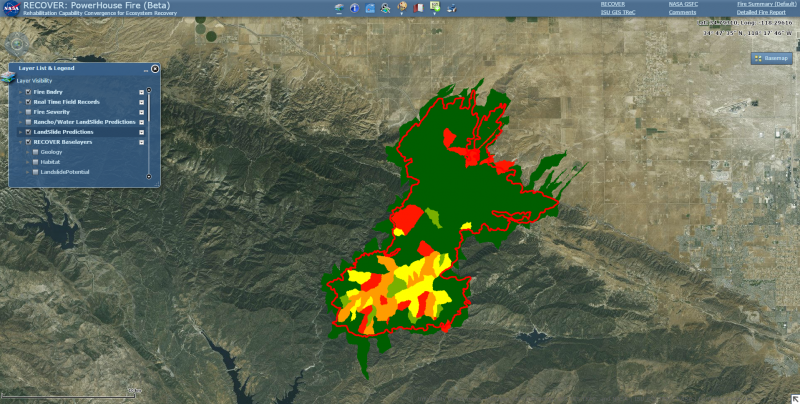
The Powerhouse Fire of 2013 led to extensive debris flows in the Lake Hughes area in Los Angeles County in October, 2015. For more information about this and other post-wildfire debris flow, click here. For more information about the NASA RECOVER Post-fire Planning Project, click here.
–
–
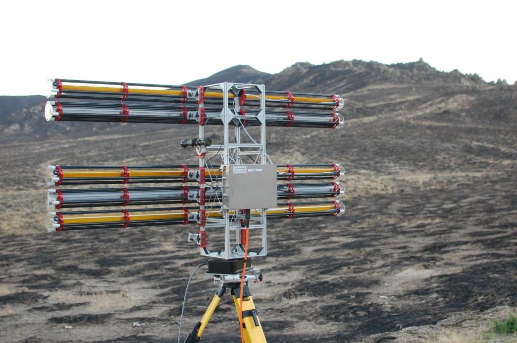
Researchers from the University of Arkansas and Michigan Technological University collect RADAR data from the Soda Fire site in Owyhee County, Idaho, in October, 2015.
–
–
Dr. Richard Coffman demonstrates ground-based radar interferometry at the 2012 Charlotte Fire site to attendees of the NASA Applied Remote Sensing Training workshop in Pocatello, Idaho, in October, 2015.
–
–
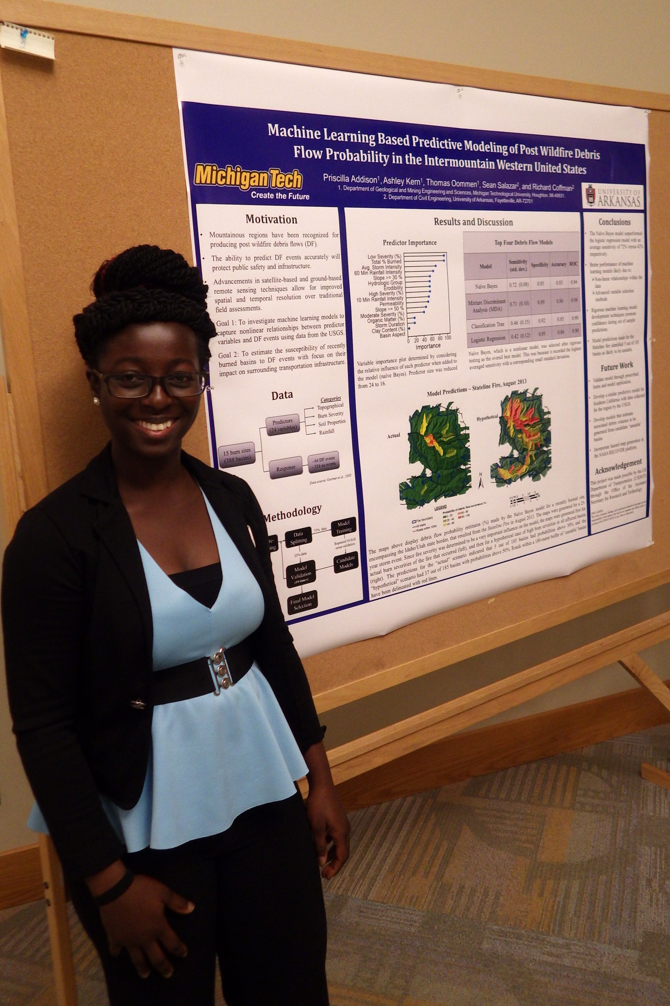
Priscilla Addison presents a research poster entitled “Machine Learning Based Predictive Modeling of Post Wildfire Debris Flow Probability in the Intermountain Western United States” at the NASA Applied Remote Sensing Training workshop in Pocatello, Idaho, in October, 2015.